

Clarkson & Biddle Plan of Philadelphia (1762)
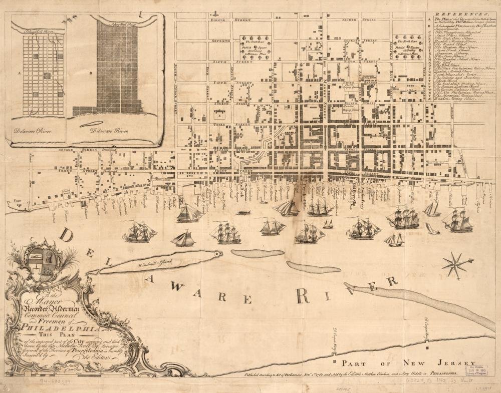
Year Mapped: by 1761 (Nicholas Scull’s final survey)
First Published: 1762, Philadelphia; sold by the editors Matthew Clarkson and Mary Biddle
Cartographer: Surveyed by Nicholas Scull (1686?–1761); published posthumously by Clarkson & Biddle
Source: Library of Congress
Type: Large-scale plan of the built-up city; wharves with owners’ names
Period: Philadelphia 1776
Digital Access: https://www.loc.gov/item/74692589/
Coverage: The “improved part” of the city, Delaware waterfront detail
Summary
Full title: To the Mayor, Recorder, Aldermen, Common Council, and Freemen of Philadelphia this Plan of the Improved Part of the City… Surveyed by Nicholas Scull and published after his death by Matthew Clarkson and his daughter Mary Biddle — one of the earliest American maps credited to a woman. At ca. 1:4,900 it is the most detailed pre-Revolutionary plan of the urban core: street grid, index to points of interest, wharves named for their owners, ships in the Delaware, and two insets. LOC scan is 10,568 × 8,298 px with IIIF.
Parcel-readiness: MEDIUM-HIGH
- Excellent street/wharf/block geometry for the pre-1776 core; not a full lot-by-lot cadastre (use Reed 1774 for that)
- IIIF:
https://tile.loc.gov/image-services/iiif/service:gmd:gmd382:g3824:g3824p:ar130800/info.json
Sources
- Library of Congress: item 74692589 · resource viewer
Cross-references
- Philadelphia 1776
- Reed Map of Philadelphia (1774)
- Faden Plan (1777) (derived from the Scull & Heap survey tradition)