

Reed Map of the City and Liberties of Philadelphia (1774)
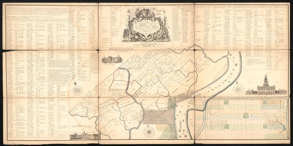
Year Mapped: 1774 (lot fabric back to Penn’s original purchasers)
First Published: 1774; engraved by James Smither. LOC digital copy is the 1870 Charles L. Warner facsimile (Worley & Bracher)
Cartographer: John Reed (1738–1776)
Source: Library of Congress
Type: Cadastral — individual lots with owner names, city and Liberties
Period: Philadelphia 1776
Digital Access: https://www.loc.gov/item/85693372/
Coverage: City of Philadelphia + Northern and Southern Liberties
Summary
The single best parcel source for Revolutionary-era Philadelphia — a true cadastral map showing individual lots keyed to a catalogue of purchasers (owner names), published with the companion pamphlet An Explanation of the Map of the City and Liberties of Philadelphia. The Library of Congress scan (of the 1870 facsimile, public domain) is 18,202 × 9,076 px with a IIIF endpoint, ready for georeferencing and lot digitization in QGIS.
Parcel-readiness: HIGH
- Individual lot lines city-wide, with landowner index
- IIIF:
https://tile.loc.gov/image-services/iiif/service:gmd:gmd382:g3824:g3824p:ct008331/info.json - Caveat: land-title map, not a building survey — pair with Hills 1796 for footprints
Sources
- Library of Congress: item 85693372 · resource viewer
- Companion pamphlet (1774): Internet Archive
- Original 1774 impressions: Historical Society of Pennsylvania; American Philosophical Society (digitized)