

Easburn Plan of the City of Philadelphia (1776)
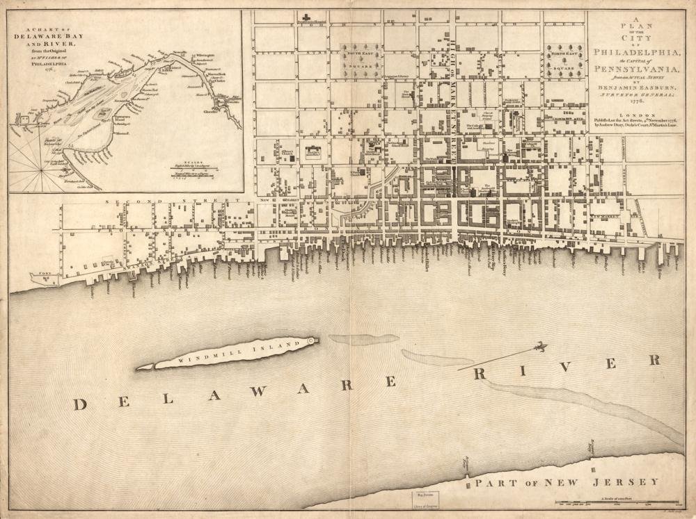
Year Mapped: from Benjamin Easburn’s surveys (surveyor general 1733–1741), updated to 1776
First Published: London, November 1776, by Andrew Dury
Cartographer: Benjamin Easburn; Peter André; published by Andrew Dury
Source: Library of Congress
Type: City plan with named public buildings and wharves; Delaware Bay inset
Period: Philadelphia 1776
Digital Access: https://www.loc.gov/item/gm71002155/
Coverage: Full Penn grid, Delaware to Schuylkill; inset chart of Delaware Bay & River
Summary
A Plan of the City of Philadelphia, the Capital of Pennsylvania, from an Actual Survey — the definitive 1776-dated snapshot of the city, rushed out in London as the Revolution made Philadelphia front-page news. At ca. 1:5,000 it shows the full street grid with the names and locations of important buildings and wharf facilities. LOC holds three copies (one from the Peter Force collection); the scan is 10,779 × 8,058 px with IIIF.
Parcel-readiness: MEDIUM
- The right base map for what existed in 1776, but blocks rather than individual lots
- IIIF:
https://tile.loc.gov/image-services/iiif/service:gmd:gmd382:g3824:g3824p:ar131200/info.json
Sources
- Library of Congress: item gm71002155 · resource viewer
- Same scan mirrored on Wikimedia Commons (public domain)