

Hills Plan of Philadelphia (1796)
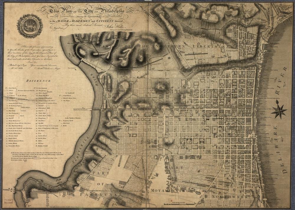
Year Mapped: 1796 (presentation dated September 5, 1796)
First Published: 1797, by John Hills, Philadelphia
Cartographer: John Hills, surveyor & draughtsman; engraved by John Cooke
Source: Library of Congress
Type: City plan showing all buildings, wharves, tract lines
Period: Philadelphia 1776
Digital Access: https://www.loc.gov/item/2007625050/
Coverage: City of Philadelphia and environs (“the improved parts”)
Summary
The finest building-level survey of 18th-century Philadelphia. Per the LOC catalog it “shows all buildings, names of wharves and landings along the Delaware riverbank, wooded areas, and tract lines beyond the city borders.” Twenty years after independence, it is the key cross-reference for which 1776 structures survived and how the city grew. LOC scan is 11,428 × 8,159 px with IIIF.
Parcel-readiness: HIGH (building footprints)
- Every building drawn; wharf owners named
- IIIF:
https://tile.loc.gov/image-services/iiif/service:gmd:gmd382:g3824:g3824p:ct001369/info.json - Hills’s later 1808 plan exists as a georeferenced tile layer at philageohistory.org — a useful warping crib
Sources
- Library of Congress: item 2007625050 · resource viewer
Cross-references
- Philadelphia 1776
- Reed Map of Philadelphia (1774)
- John Hills Plan of NYC (same surveyor)